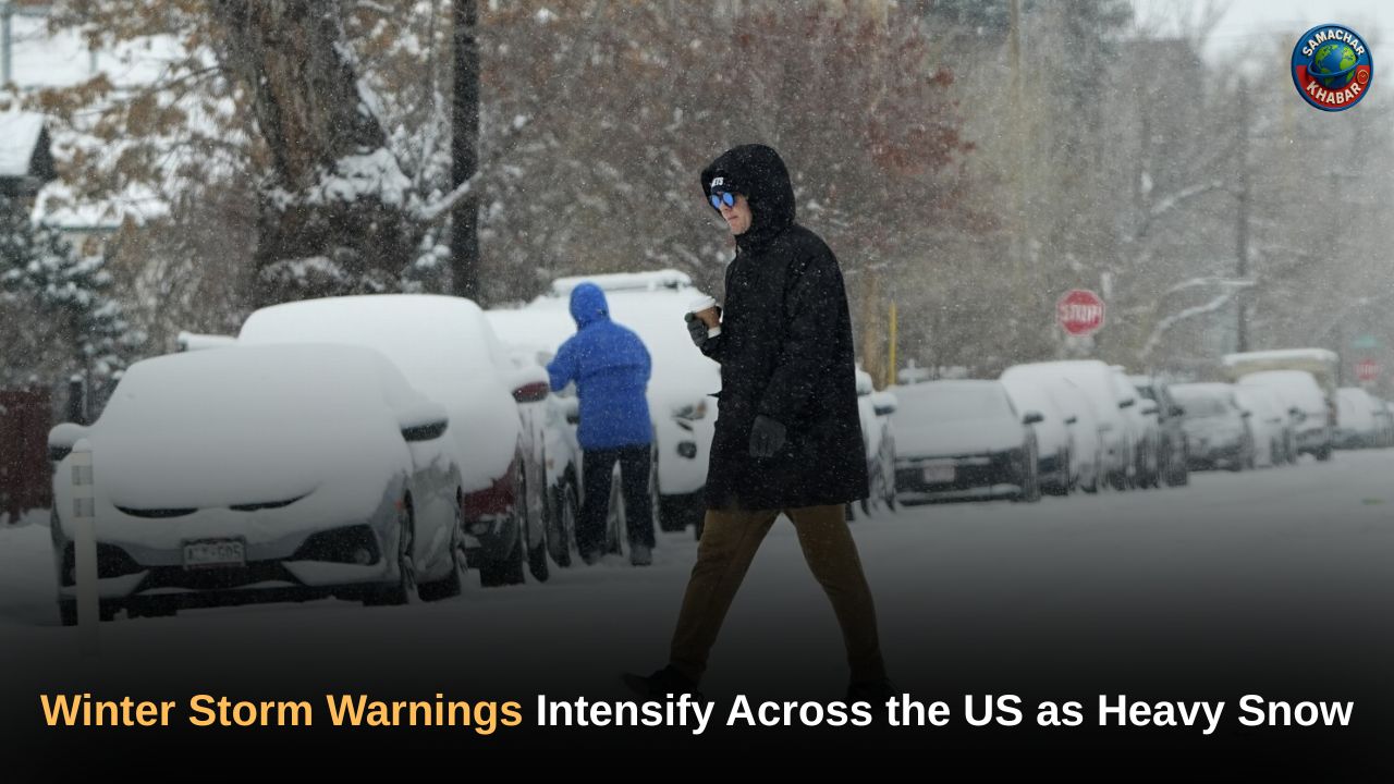
The United States is facing one of the earliest and most widespread winter weather emergencies in recent years, as a powerful combination of heavy snowfall, extreme cold and fast-moving storm systems sweeps across the Northeast, Midwest, South and the western mountain regions. From Vermont to California and from Michigan to Georgia, millions of Americans are under winter storm warnings, travel alerts and cold advisories.
Meteorologists say that snowfall totals reaching up to 18 inches, record-setting temperature drops, lake-effect snow, and even thundersnow are creating dangerous conditions beginning Sunday and continuing into mid-week.
Key Takeaways: Widespread Winter Storm Impact Across the United States
- Up to 16–18 inches of snow expected in parts of the Northeast, Midwest and Sierra Nevada.
- Record-breaking cold grips the eastern half of the US with multiple low-temperature records broken.
- Thundersnow, lake-effect bands, and near-zero wind chills creating hazardous travel conditions.
- Winter storm warnings issued across Pennsylvania, New York, Vermont, Maine, Michigan, Indiana, Wisconsin, and western states including California and Nevada.
- Southern states including Texas, Oklahoma, Alabama and Georgia under freezing temperature advisories.
- Meteorologists caution that travel disruptions, blowing snow, and poor visibility may persist into Tuesday.
Northeast Braces for Heavy Snow as Early-Season Storm Intensifies
The National Weather Service (NWS) confirmed that the early-season storm began Sunday morning, with snowfall intensifying late into the night and continuing through Monday. NWS meteorologist Eric Myskowski noted that the projected snowfall totals are “on the high side for this early in the season,” particularly in regions of New York and Vermont.
By Monday morning, winter weather advisories were in effect across Pennsylvania, New York, Vermont and Maine, while more severe winter storm warnings were issued for New York and Vermont. Snowfall had already been recorded across many of these areas, with meteorologists warning that substantial additional accumulation was still expected before the system weakens.
Vermont Expected to See the Highest Snowfall Totals
The heaviest snowfall totals are forecast for the NWS Burlington, Vermont region, covering:
- Southeastern St. Lawrence
- Southern Franklin
- Western Clinton
- Washington
- Orleans
- Eastern Chittenden
- Eastern Franklin
- Lamoille Counties
According to NWS Vermont, “moderate to heavy snow” is expected, with an additional 3 to 8 inches, bringing storm totals to 8 to 10 inches, while 10 to 16 inches are possible along the northwestern slopes.
New York Prepares for Harsh Conditions With Travel Disruptions Likely
Parts of New York, particularly near and north of Route 28 in northern Herkimer County, could receive up to 14 inches of snow.
The NWS Albany office warned that:
- Roads may become slick and hazardous
- Visibilities could drop below one mile
- Blowing snow may worsen morning travel conditions
NWS Buffalo added that snow-covered roads and reduced visibility would require drivers to “slow down and use caution.”
Midwest Hit by Heavy Snow, Blowing Winds and Thundersnow
Parallel to the Northeast storm, the Midwest is experiencing its own winter hazards. Meteorologists issued winter weather advisories for Michigan, Indiana and Wisconsin, with significant snowfall already measured.
Key Midwest impacts include:
- Michigan’s Upper Peninsula reporting up to one foot of snow and low visibility
- Indiana expecting up to 11 inches
- Wisconsin predicted to receive up to 6 inches
In parts of Illinois, Indiana and Wisconsin, the cold spell produced lake-effect snow, a weather pattern that forms when freezing air sweeps across relatively warmer lake water. Northern Indiana saw some of the highest totals, including 12 inches at Cedar Lake, while parts of Chicago received 2–3 inches.
Meteorologists also reported instances of thundersnow, where lightning occurs during intense snow bands — a phenomenon seen in this storm system.
Record-Breaking Cold Sweeps Across the Eastern and Southern United States
The eastern half of the country has been experiencing an exceptional early-winter cold spell, breaking numerous low-temperature records. On 11 November alone, 80 weather stations across the Deep South tied or broke their daily minimum temperatures.
Notable temperature drop:
- Jacksonville, Florida recorded –3°C, around 17°C below the climatological average for this time of year.
Cold weather warnings were also issued for Ohio, West Virginia and Kentucky, while freezing temperatures spread across Texas, Oklahoma, Alabama and Georgia.
Typhoon Fung-wong Brings Record Rainfall and Severe Flooding to Taiwan
While the US battles widespread winter storms, Taiwan has been facing its own weather emergency as Typhoon Fung-wong moved away from the Philippines and turned north-northeast toward the island. The system made landfall as a tropical storm but still produced record-setting rainfall across eastern Taiwan. The town of Suao in Yilan County recorded 648 mm (25 inches) of rain through Tuesday, triggering widespread flooding.
Floodwaters reached 61 cm (2 feet) inside homes, forcing 8,300 residents to evacuate to safer areas inland. Despite significant preparation efforts, authorities reported 51 people injured during the flooding. After landfall, Fung-wong weakened into a tropical depression before dissipating on Thursday as it moved further northeast.
Western US Faces Its Own Winter Storm Emergency
While the Northeast battles widespread snow, the West Coast and Intermountain West are also bracing for heavy winter conditions.
California: Sierra Nevada Hit With 12–18 Inches of Snow
The NWS issued a winter storm warning for the Central Sierra region, mainly south of I-80, predicting:
- 12 to 18 inches of heavy snow
- Snow levels between 5,500 and 6,500 feet
- Strongest accumulation expected Tuesday evening through early Wednesday
Travel is expected to be “very difficult,” particularly across mountain passes.
Nevada: Ruby Mountains and East Humboldt Range
Northern and Central Nevada could see:
- Up to 15 inches of snow in the Ruby Mountains and East Humboldt Range
- Snow-covered roads expected along State Route 229 (Secret Pass), Lamoille Canyon and Harrison Pass
Wyoming Weather Outlook
NWS Riverton forecast widespread rain and snow, with higher elevations in western Wyoming receiving the heaviest winter precipitation.
Spiritual Insight: Teachings of Saint Rampal Ji Maharaj in Challenging Times
Amid severe weather events and rising climate uncertainties, many people are turning toward spiritual guidance to find clarity and inner stability. Followers of Saint Rampal Ji Maharaj Ji highlight that his unique spiritual knowledge, based on the scriptures of all major religions, teaches how true peace and protection come from connecting with the Supreme God rather than worldly measures alone.
His discourses emphasize that natural disasters, extreme cold, and unpredictable conditions reflect a deeper imbalance in human conduct and spiritual discipline. According to his teachings, adopting Sat-Bhakti—the scripture-based worship he explains—helps individuals lead a life rooted in morality, compassion and divine protection.
As global challenges intensify, many believe his spiritual path offers a meaningful direction for humanity, providing mental resilience and a sense of safety beyond physical circumstances.
A Deepening Winter Pattern: What These Early Storms Signal
These widespread winter warnings mark an unusually early and intense start to the season. The combination of record-breaking cold, heavy multi-state snowfall, lake-effect storms, and mountain snow systems indicates a weather pattern capable of repeated disruptions. Meteorologists warn that while many alerts will expire by Monday night, some could linger into Tuesday, and additional winter systems may follow.
Residents across affected regions are urged to remain aware of official updates, avoid unnecessary travel and prepare for rapidly changing winter conditions.
FAQs on the US Winter Storm and Early Winter Cold Spell
1. How much snowfall is expected during the US winter storm?
Several regions may receive 12–18 inches of snow, with Vermont, the Sierra Nevada, Michigan, and Indiana among the hardest-hit areas.
2. Which states are under winter storm warnings?
Warnings cover Pennsylvania, New York, Vermont, Maine, California’s Sierra, Nevada, Michigan, Indiana, Wisconsin, Ohio, Texas, Oklahoma, Alabama, Georgia, and more.
3. Why is this winter storm considered significant?
It combines heavy snowfall, thundersnow, lake-effect snow, and record-breaking cold, making it one of the earliest and strongest multi-state winter events this season.
4. What travel impacts are expected?
Drivers may face slick roads, low visibility, blowing snow, and challenging mountain-pass conditions from Vermont and New York to California and Nevada.
5. Are other weather events occurring alongside the winter storm?
Yes. Typhoon Fung-wong brought record rainfall and flooding to Taiwan, highlighting global extreme weather during the same period.