A rare and unusually early weakening of the polar vortex is triggering concern among meteorologists, as new atmospheric signals suggest a sharp shift toward colder, stormier weather after Thanksgiving across large parts of the United States. Multiple forecasting agencies — including the Climate Prediction Center (CPC), NOAA experts, ECMWF modelers, and leading climatologists — report that a sudden stratospheric warming (SSW) event may be unfolding over the next several days.
This early-season disruption, almost unheard of in November, could send Arctic air plunging southward and reshape winter conditions across North America, Europe and Asia well into December.
Key Takeaways: Rare Polar Vortex Disruption and Its Impact on U.S. Weather
- Sudden stratospheric warming is weakening the polar vortex unusually early in the season.
- Cold Arctic air may plunge into the U.S. after Thanksgiving, spreading into early December.
- The West, Northern Plains, and Central Plains could see temperatures 20–30°F below average.
- New England, including Massachusetts, may see below-average temperatures in early December.
- La Niña, MJO, and QBO patterns are influencing the jet stream and Arctic air movement.
- A similar November event has not been recorded in the satellite era, making this highly rare.
- Snow potential increases significantly in early December, especially for the Midwest.
Stratospheric Changes Signal a Sudden Winter Pattern Shift
High above the North Pole, temperatures in the stratosphere are rising sharply — a hallmark of sudden stratospheric warming (SSW). Despite the name, warming aloft often brings colder weather at the surface, as the event weakens the fast-moving polar vortex that usually traps frigid Arctic air near the pole.
NOAA meteorologist Amy H. Butler notes that vortex winds may slow or even reverse, disrupting the flow that keeps cold air bottled up. Once disturbed, the vortex behaves “like a spinning top losing balance,” allowing Arctic air to spill into mid-latitude regions, including the U.S., Europe, and Asia.
Judah Cohen of MIT says an event of this strength in November is “highly unusual,” with no comparable cases in the satellite era.
How the Polar Vortex Works and Why Its Weakening Matters
The polar vortex is a broad area of low-pressure, icy air swirling above the Arctic. Its strength determines how winter unfolds:
| Polar Vortex State | Impact on U.S. Weather |
| Strong Vortex | Cold stays locked in the Arctic; U.S. winter is milder. |
| Weak Vortex | Cold spills south, causing Arctic blasts and heavy snow potential. |
A weak vortex allows the jet stream to buckle, sending lobes of cold air toward mid-latitude regions. This leads to episodic cold snaps, rapid temperature swings, and increased storminess.
Experts warn that this year’s weakening vortex may send waves of cold rather than one long freeze — a pattern more typical of disrupted SSW events.
Thanksgiving Week: Cold Expands Across Western and Central U.S.
The Climate Prediction Center forecasts a significant temperature drop from Nov. 24 to Nov. 30, especially across the western United States. Much of the region may experience below-normal temperatures, with colder weather pushing into the Northern and Central Plains.

Ski resorts in the Rocky Mountains may benefit from early winter conditions, according to MIT’s Judah Cohen.
Across the Northeast, including Massachusetts, Thanksgiving itself looks relatively mild, though rain and gusty winds could create travel disruptions. Forecasters warn of potentially strong winds affecting major holiday events such as the Macy’s Day Parade in New York City.
Early December: Winter Intensifies Across the Northern Half of the U.S.
As the vortex continues weakening, temperatures may plunge further in early December.
Key expected regional impacts include:
Pacific Northwest & Northern Plains
- Temperatures could run 20–30°F below average.
- Repeated Arctic bursts are likely.
Central U.S.
- Transition to more winter-like conditions.
- High likelihood of below-normal temperatures and possible heavy snow.
New England (Including Massachusetts)
- It’s getting colder at the start of December, but not extreme.
- Below-average temperatures with variability and short cold snaps.
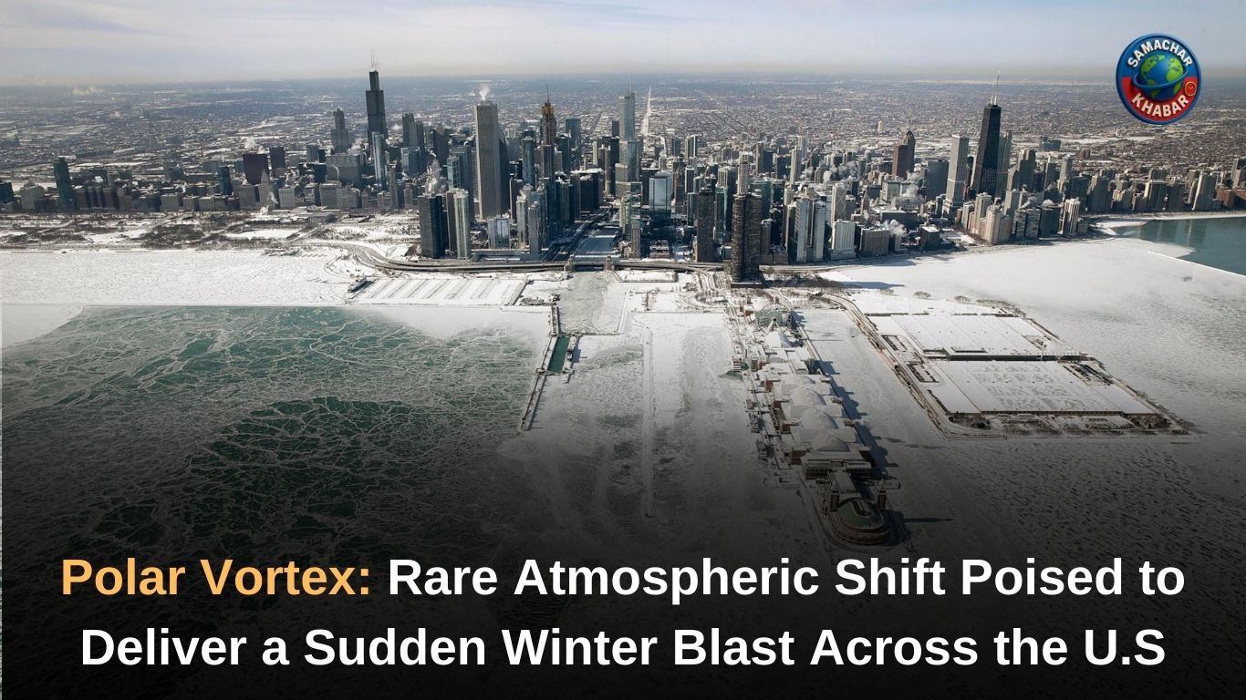
Chicago, meanwhile, may see Arctic air shortly after Thanksgiving, with chances of significant snow increasing in early to mid-December. Early signs suggest snow systems may stay south of the region through November but shift northward as the jet stream evolves.
Atmospheric Drivers Behind the Sudden Pattern Change
Several global climate patterns are aligning simultaneously, influencing how the cold air spreads:
La Niña
- Confirmed in September.
- Tends to push Arctic air toward the western half of North America.
- Increases the risk of cold outbreaks in northern states.
Madden-Julian Oscillation (MJO)
- Tropical thunderstorm patterns alter jet stream behavior.
- Helps determine how deep cold air can penetrate.
Quasi-Biennial Oscillation (QBO)
- Currently in its easterly phase, making the polar vortex more prone to wobbling south.
This combination of atmospheric signals has created what some experts call a “critical juncture” that may direct the course of winter across the Northern Hemisphere.
Travel and Safety Impacts: What Americans Should Expect
With colder weather arriving just as millions travel for the holiday, forecasters warn of:
- Heavy snow and cold rain across the western U.S. and Midwest.
- Gusty post-storm winds spreading from the Great Lakes to the Northeast.
- Potential travel delays at major airports.
- Road hazards in regions experiencing the first significant snow.
Even after the holiday, temperature swings may be sharp, with forecasters noting “quick rebounds” between warm and cold days.
Nature’s Warnings and the Teachings of Saint Rampal Ji Maharaj
In times of sudden climatic shifts and unpredictable natural patterns, Saint Rampal Ji Maharaj explains that nature follows the supreme laws of the Almighty. According to His spiritual teachings, disturbances in weather, imbalance in seasons, and rising global uncertainties are signs urging humanity to adopt true devotion and righteous conduct.
His unique knowledge, based on the eternal scriptures, guides society to reconnect with the Supreme Power who alone governs creation, preservation, and nature’s equilibrium. By embracing the path of true worship, Saint Rampal Ji Maharaj teaches that mankind can achieve peace, stability, and harmony with the natural world around us.
A Defining Weather Shift That Could Shape the Entire Winter
Meteorologists agree on one point: the atmosphere is at a pivotal turning point. A rare November SSW event — if confirmed — would be the first of its kind in the satellite era and could influence winter patterns for weeks.
While not all regions will experience severe Arctic outbreaks, many parts of the United States face a colder, more volatile start to December. With the polar vortex wobbling and global climate patterns aligning, Americans should prepare for a winter that begins earlier, hits harder, and unfolds unpredictably.
FAQs on the Early Polar Vortex Disruption and Sudden Winter Shift
1. What is causing the early weakening of the polar vortex this year?
A rare sudden stratospheric warming event is weakening the polar vortex unusually early, allowing Arctic air to move south into the United States.
2. Will the U.S. see a major cold blast after Thanksgiving?
Yes, many regions—especially the West, Northern Plains, and Midwest—may experience sharp temperature drops and winter-like conditions after Thanksgiving.
3. Which areas will experience the coldest temperatures?
The Pacific Northwest, Northern Plains, and Central Plains may see temperatures 20–30°F below average due to the weakened polar vortex.
4. How will La Niña and MJO influence this weather pattern?
La Niña and the Madden-Julian Oscillation are altering the jet stream, guiding Arctic air south and increasing the likelihood of early December cold outbreaks.
5. Could this pattern lead to snowstorms in early December?
Yes, meteorologists expect higher snow potential in early December, especially across the Midwest and central U.S., as the jet stream guides colder air and storm systems.