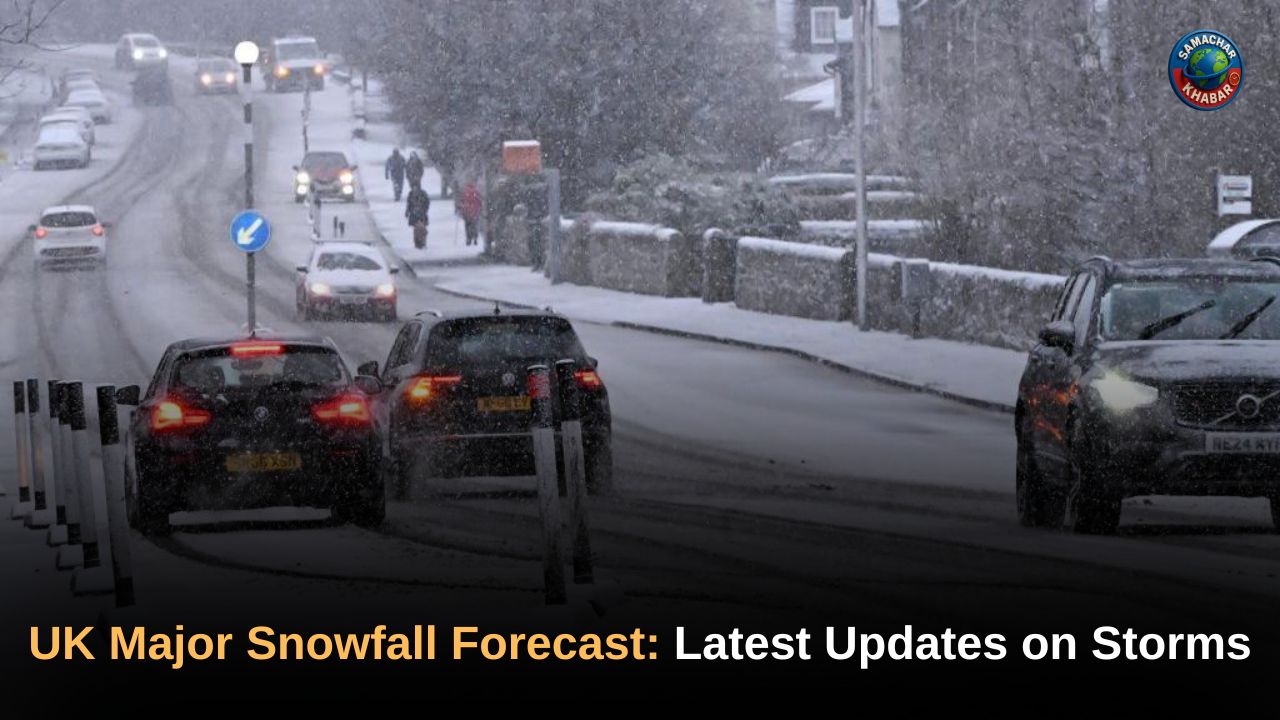
UK Major Snowfall Forecast: Britain is experiencing one of its most severe early-winter outbreaks in over a decade as major snowfall, Arctic winds, freezing rain and widespread ice grip the country. With temperatures plunging to –12.6°C in Scotland and heavy blizzards sweeping across England, Wales and Northern Ireland, the UK has entered a deep winter phase far earlier than usual.
The unfolding conditions have shut schools, blocked key transport routes, disrupted flights and triggered dozens of weather warnings. Forecasting maps from WXCharts and Ventusky continue to turn white and purple, signalling more snow in the coming days as the Arctic climate shift intensifies.
Key Takeaways: UK Major Snowfall Forecast, Storm Warnings and Climate Impact
- UK records –12.6°C, the coldest autumn night and coldest November in 15 years.
- Snowstorms, blizzards, ice and freezing rain cause nationwide disruption.
- 41 regions under Met Office yellow warnings for snow, ice and freezing conditions.
- A rare 50-mile freezing-rain event strikes the west coast of Scotland.
- Thundersnow is observed in Aberdeenshire and the north-east coast.
- Schools, roads, rail and airports face heavy impact across England, Wales and Scotland.
- WXCharts predicts fresh snowfall on November 30 across Birmingham, Manchester, Bristol, Leeds, Cotswolds and Stoke-on-Trent.
- The forecast warns of one or more snow spells in early December as colder air returns.
- Temperatures may rise slightly by the weekend but hazardous conditions will linger.
UK Suffers Coldest November Night in More Than a Decade
The UK has plunged into a severe winter phase, with Scotland recording a brutal –12.6°C, the lowest November temperature in 15 years. England and Wales also experienced extreme lows, including –6.6°C at RAF Benson in Oxfordshire, –6.4°C in Sennybridge in Powys and –2.8°C in Co Antrim.
North Yorkshire, which saw heavy inland snowfall earlier in the week, joined regions facing extensive disruption as snow showers rolled in from the North Sea.
Blizzards and 25 cm Snowfall Under Rare Amber Alert
A rare amber weather alert was issued for the North York Moors and Yorkshire Wolds from 3am to 9pm, warning of occasional blizzards and up to 25 cm of snow on high ground. This level of early-season snowfall is unusual, with historic records showing that significant November snow arose primarily in 1925.
The heavy snowfall forced many communities into isolation for hours, with roads blocked and power outages reported across several regions.
Major School Closures Across the UK
The worsening weather forced widespread school closures:
- Scotland: Over 90 schools shut in Aberdeenshire
- Wales: 36 in Pembrokeshire, 14 in Carmarthenshire, 7 in Ceredigion
- England: 30 closed in North Yorkshire, 8 in East Yorkshire and several in Northumberland
The closures affected tens of thousands of students and staff as icy roads made travel dangerous.
Freezing Rain: 50-Mile Rare Weather Phenomenon Hits Scotland
One of the most unusual events of this cold spell was a 50-mile stretch of freezing rain detected from Armadale to Dumbarton on Scotland’s west coast.
The Met Office explains that freezing rain is rare in the UK because it requires very specific atmospheric layers. It freezes instantly on impact, forming a dangerous glaze capable of:
- Pulling down trees and power lines
- Turning roads and pavements into invisible ice sheets
- Creating high-risk conditions for aircraft during landing and take-off
Temperatures in Scotland during this event were between –1°C and –3°C, with Hereford and Gloucester dropping to –4°C.
Full List of 41 UK Areas Under Met Office Weather Warnings
The Met Office issued widespread yellow warnings for snow and ice across 41 regions, including:
- Scotland: Aberdeen, Aberdeenshire, Moray, Highlands & Eilean Siar, Highland, Orkney Islands, Shetland Islands
- North East England: Darlington, Durham, Gateshead, Hartlepool, Middlesbrough, Newcastle, North Tyneside, Northumberland, Redcar & Cleveland, South Tyneside, Stockton-on-Tees, Sunderland
- SW Scotland & Borders: East Lothian, Scottish Borders
- Yorkshire & Humber: East Riding of Yorkshire, Kingston upon Hull, North Yorkshire, York, North Lincolnshire, North East Lincolnshire
- East Midlands: Lincolnshire
- East of England: Cambridgeshire, Essex, Norfolk, Suffolk
- London & South East: East Sussex, Kent
- Wales: Carmarthenshire, Ceredigion, Conwy, Gwynedd, Isle of Anglesey, Pembrokeshire
Snow depths reached up to 5 cm in parts of Scotland and up to 3 cm in Newcastle.
Road, Rail and Air Travel Brought to a Standstill
Travel across the UK deteriorated sharply:
Road Closures
- A1 northbound (Morpeth to Alnwick) closed for more than two hours.
- A171 and A169 shut down alongside multiple rural routes.
- North Yorkshire Police urged residents to make only essential journeys.
- Pembrokeshire authorities warned of “extremely hazardous conditions on most roads.”
Rail and Air Disruption
- Heavy snow affected signals and tracks across northern England.
- Airports including Newcastle, Leeds Bradford and Edinburgh reported delays due to snow-covered runways.
Driving Risk
AA experts warned that stopping distances can increase tenfold on icy surfaces, urging drivers to travel slowly, stick to main routes and allow extra time.
More Snow Expected: November 30 and Early December Outlook
WXCharts forecasting maps have turned white and purple for November 30, indicating fresh snowfall across:
- Birmingham
- Manchester
- Bristol
- Leeds
- The Cotswolds
- Stoke-on-Trent
The coldest conditions will again centre around Inverness and Aberdeen, potentially dropping to –6°C.
The Met Office long-range forecast (Nov 27–Dec 6) highlights:
- More unsettled conditions returning mid-week
- Frost and fog risk increasing
- Wind and rain possible but less frequent initially
- Temperatures shifting from cold to slightly above average
From Dec 6 to Dec 20, more settled spells may occur, but colder blasts — especially in the north — could produce one or more spells of snow, especially when southern weather systems meet cold air.
White Christmas Odds Rise Amid Abundant November Snow
With the UK witnessing unusually early snow, bookmakers have sharply increased the chances of a White Christmas:
- Aberdeen: 6/5
- Newcastle: 7/4
- London: 7/1
Many residents across the country remarked that they could not remember winter starting this severely this early.
A Nation Bracing for the Winter Ahead
The UK is battling a potent mix of Arctic air, blizzards, freezing rain and deepening ice that has disrupted every aspect of life — from travel routes to schools and public services. While temperatures are expected to rise slightly by the weekend, the embedded impacts of the cold spell, ongoing risks of frost and renewed snowfall in early December mean the situation remains fragile. As the nation prepares for more winter hazards, vigilance, caution and regular weather updates remain essential.
FAQs on UK Major Snowfall Forecast, Storms and Climate Impact
1. What is causing the major snowfall and Arctic conditions in the UK?
An Arctic blast, freezing air and active storm systems are causing widespread snowfall, blizzards, freezing rain and severe ice across multiple UK regions.
2. Which UK areas are under Met Office snow and ice warnings?
The Met Office has issued warnings for 41 regions, including Scotland, North-East England, Yorkshire, East Midlands, East England, South-East England and Wales.
3. How severe are the current UK temperatures during the cold spell?
Temperatures have fallen to –12.6°C in Scotland, –6.6°C in Oxfordshire, –6.4°C in Powys and –2.8°C in Co Antrim.
4. Where is more snowfall expected in the coming days?
WXCharts forecasts show fresh snowfall on November 30 across Birmingham, Manchester, Bristol, Leeds, the Cotswolds and Stoke-on-Trent.
5. Will the UK get more snow in early December?
Yes. The Met Office says one or more snow spells are possible in early December as colder air meets incoming southern weather systems.