[ad_1]
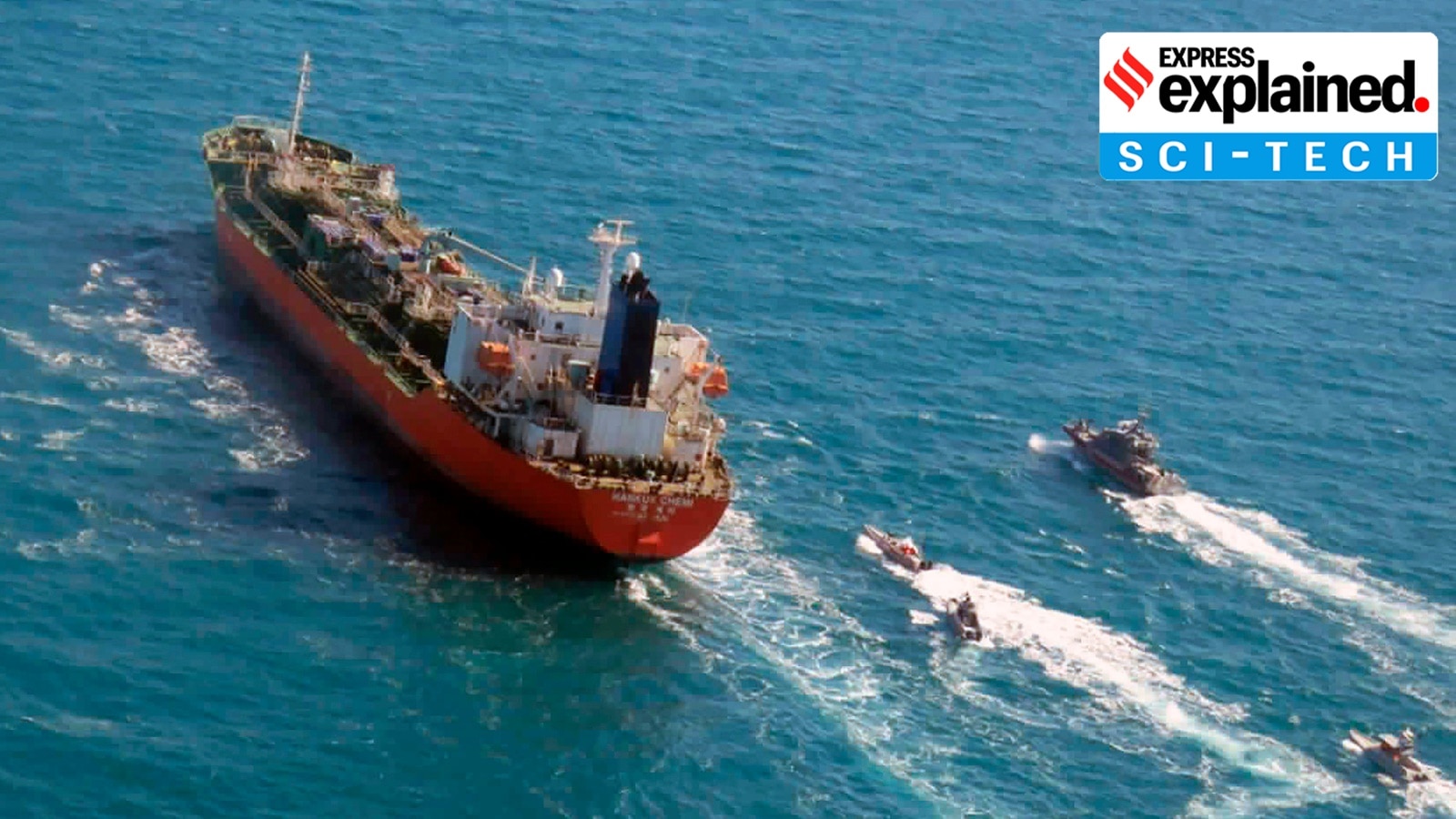
The war waged by the US and its allies against Iran, which began on February 28, has upended shipping and critical supplies of oil and gas through the Strait of Hormuz.
In addition to physical warfare, both sides have seen their navigation systems go haywire, erroneously indicating that ships were located at airports, on land or at nuclear power plants. This has been made possible through electronic interference, such as GPS spoofing or jamming.
Both ships and aircraft depend on global navigation satellite systems (GNSS) for position, navigation, and timing (PNT) information. Of these, the American Global Positioning System (GPS) is the most popular GNSS, with the terms often used interchangeably. But there are other GNSSs as well, like Europe’s Galileo, Russia’s GLONASS, China’s BeiDou and India’s NavIC.
These systems include ground infrastructure and satellite constellations that provide PNT information by determining the position of a GNSS signal receiver. Vessels are equipped with these receivers, and vehicles with navigational aids. While these systems have a high degree of accuracy, satellite navigation signals are weak and, therefore, vulnerable to interference.
GPS jamming or spoofing are two deliberate types of cyberattacks on GNSS signals to disrupt or trick the navigation systems of vehicles. Despite being used synonymously, they refer to two different things.
GPS jamming involves the use of a device called a jammer to overpower weaker signals with ‘noise’ on the same frequency. GPS spoofing, on the other hand, mimics the GPS signal and provides the pilot (or captain) with false information about their actual location.
Of the two, spoofing is the more serious offence, disrupting signals and forcing pilots, for instance, to incorrectly account for factors such as altitude or terrain. Spoofing may tell an aircraft it is in a location it isn’t supposed to be in, and create confusion in the cockpit.
Story continues below this ad
GPS interference in West Asia
According to Windward, a maritime company, over 1,650 vessels experienced interference in their GPS and Automatic Identification Systems (AIS) across West Asia on March 7, a 55% increase over the previous week. The company identified at least 30 jamming clusters across Saudi Arabia, Kuwait, the UAE, Qatar, Oman, and Iran, both on land and at sea.
Satellite images accessed by the company showed that shipping clusters had changed from crop circle-like patterns to zigzag patterns, throwing ships’ signals across multiple locations.
Presented with misleading location data, ships could be run off course, with an increased risk of collision with other vessels or tankers or of running aground. At the same time, there is the risk of false compliance alerts in one of the world’s most vital energy corridors.
While there is no official confirmation about who is responsible for the widespread jamming, Iran has been suspected of causing disruption to vessels, the BBC reported. Iran has previously threatened to attack any ship attempting to pass through the Strait of Hormuz.
Persistent warfare tactic
Story continues below this ad
The use of GPS or AIS interference is not a new phenomenon. In war zones, electronic interference attempts to disrupt the navigation systems of missiles or drones, which may rely on location data to find and hit their targets.
GPS interference has been reported in the war between Russia and Ukraine, where large-scale drone-based warfare was observed for the first time. GPS and AIS interference about the Strait of Hormuz isn’t a new phenomenon, with significant jamming recorded while Israel and Iran traded strikes in June 2025. AIS is used by ships in part to prevent collisions.
India has also faced electronic interference: Last November, the Indira Gandhi International Airport saw major flight disruptions, with a planned upgrade of airport systems causing the shutdown of IGIA’s instrument landing system. While such systems are unaffected by GPS interference while functional, in its absence, aircraft typically rely on GPS-based Required Navigation Performance (RNP) guidance to land, but the recent GPS spoofing around Delhi has disrupted these signals.
Between November 2023 and February 2025, around 465 incidents of GPS interference were reported in India’s border regions, mostly in Amritsar and Jammu, the government informed the Lok Sabha last year.
Dealing with such interference
Story continues below this ad
Aircraft experiencing GPS spoofing mid-air have to rely on alternative navigation systems, such as Inertial Navigation Systems (INS). As the primary backup, they use gyroscopes and accelerometers to track the aircraft’s current position based on its last known location. Pilots can also use celestial navigation or dead reckoning (the process of calculating one’s position by estimating the direction and distance travelled) in extreme cases, although these are less common.
Given that aircraft use of GNSS is subject to increasing levels of interference, airlines and the broader aviation ecosystem have become increasingly dependent on conventional ground-based navigation aids (GBNAs) as a backup to a loss of GPS capabilities. According to IATA, these Minimum Operating Networks (MON) will be a necessary mitigation until reliable system capabilities can be developed to suitably protect against GNSS interference.
Modern ships, on the other hand, typically run on autopilot and follow a pre-assigned course autonomously determined by a GPS-based system. During suspected spoofing, the ship’s crew resorts to manual helm control-steering with terrestrial navigation, which involves manual position fixing using land-based aids like lighthouses and radars, the immediate alternative to maintain situational awareness.
Shipping companies have sought to reduce their dependence on the American GPS and use multi-constellation GNSS to mitigate against GPS interference.
Story continues below this ad
The Indian military has deployed the indigenous Navigation with Indian Constellation (NavIC), developed by the Indian Space Research Organisation (ISRO). NavIC is designed to provide precise positioning and timing services across India, and up to 1,500 km beyond its borders.
[ad_2]
Source link