Red Alert Declared as Cyclone Threatens Tamil Nadu Coast: Tamil Nadu is grappling with an extraordinary surge of the Northeast Monsoon, with a developing weather system in the Bay of Bengal pushing the state into a state of high alert. The India Meteorological Department (IMD) has issued critical warnings across South India, predicting a week of relentless and potentially destructive rainfall until at least October 28.
The situation is compounded by a rapidly intensifying cyclonic circulation, threatening to concentrate into a powerful depression just off the coasts of Tamil Nadu and Andhra Pradesh.
IMD Issues High-Level Warnings Across South Peninsular India
The meteorological outlook is severe, prompting the IMD to deploy its highest alert levels for several key districts. The monsoon activity, fueled by the developing Bay of Bengal system, has demonstrated exceptional intensity, leading to widespread disruptions.
Red and Orange Alerts in Effect
The threat of extremely heavy rainfall has triggered the highest warnings, signalling an immediate need for preparedness and action in vulnerable areas.
| State | Alert Status | Affected Districts (Key Areas) | Rainfall Details |
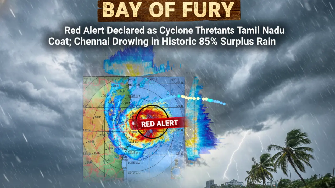
| Tamil Nadu (TN) | RED ALERT | Thiruvallur, Ranipet | Highest warning, anticipating extremely heavy rain. |
| TN / Puducherry | ORANGE ALERT | Chennai, Kancheepuram, Chengalpattu, Vellore, Salem, Krishnagiri, Dharmapuri, Tirupathur, Tiruvannamalai | Warning of heavy to very heavy rainfall. |
| Andhra Pradesh | RED ALERT | Prakasam, YSR Kadapa, Tirupati, SPSR Nellore, Annamayya | High alert for intense rainfall and associated hazards. |
| Andhra Pradesh | ORANGE ALERT | Nandyal, Anantapuramu, Srisathyasai, Chittoor, Bapatla | Warning for very heavy rainfall. |
| Karnataka | ORANGE ALERT | Udupi, Dakshin Kannada, Kodagu, Chikmagalur, Hassan | Predicted heavy to very heavy spells over Western Ghats region. |
The consistent threat of rain has been a defining feature of the week. For Chennai, residents can expect another wet day today, with intermittent spells of moderate to heavy rain accompanied by thunderstorms and lightning, a pattern set to intensify from Sunday, October 26th.
Cyclone Watch and Marine Safety Warnings
The most critical factor in the current weather crisis is the brewing system in the South Bay of Bengal. What began as a cyclonic circulation is rapidly gaining strength.
The Cyclone Development Track:
- The system is likely to move west-northwestwards.
- It is expected to concentrate into a depression over the southwest and adjoining west-central Bay of Bengal, off the coasts of North Tamil Nadu, Puducherry, Karaikal, and South Andhra Pradesh, by this afternoon.
- This track is the main feeder for the heavy rain currently lashing the region.
The sea conditions are dangerous and a clear threat to marine activity. Coastal areas along the North Tamil Nadu coast, Puducherry, and South Andhra Pradesh coasts are experiencing squally weather with wind speeds expected to range from 45 kmph to 55 kmph, and **gusting up to 65 kmph.
Also Read: Tropical Storm Jerry Forms: Where is the Atlantic’s Next Hurricane Headed?
Due to these severe conditions, fishermen have been strictly advised not to venture into the sea, while the iconic Marina Beach in Chennai has been battered by rough weather and strong winds, visually underscoring the intensifying power of the northeast monsoon.
Life Comes to a Standstill: Civic Disruption and School Closures
The sheer volume of rainfall has severely impacted normal life, leading to the predictable yet frustrating challenges of urban waterlogging and traffic disruption.
Educational Institutions Closed:
Authorities in affected regions acted swiftly to prioritize public safety by declaring holidays.
- Chennai and neighbouring Puducherry both announced school and college closures on Wednesday.
- The domino effect of the continuous downpour extended to other areas, with a holiday declared for schools across Dharmapuri on Thursday.
The Water Crisis: Too Much of a Good Thing:
The state’s infrastructure, designed to capture and store monsoon rainfall, is overwhelmed.
- Continuous rain has caused a sharp increase in water levels across major reservoirs serving the capital. The Water Resources Department has confirmed that excess water would be released from three Chennai reservoirs as their levels quickly reach full capacity.
- In a significant development reflecting the extreme intensity of the monsoon, the Mettur Dam, which is the state’s largest reservoir, has also been brought to its full capacity.
The local impact on daily life is significant, with residents navigating waterlogged roads and traffic snarls in parts of the capital and southern districts.
A Stark Look at Monsoon Surplus and Future Forecast
The current weather events are not merely an inconvenience; they highlight a remarkable period of rainfall saturation across Tamil Nadu.
Monsoon Rainfall Statistics:
- Tamil Nadu has received an overall rainfall of 21.2 cm this month.
- This figure represents an astounding 85% above normal rainfall for the season.
- The rainfall recorded has been either largely excess or normal in all districts, signifying a widespread and sustained active monsoon phase across the entire state.
- On Thursday, Arakonam in Ranipet district recorded the heaviest rainfall, with light to moderate intensity rain also falling in Tiruchi, Thanjavur, Krishnagiri, and Kanniyakumari districts.
Looking ahead, while one well-defined low-pressure area weakened on Thursday, moving towards south interior Karnataka (and is expected to merge with a system over the Arabian Sea), a new weather system is set to renew the downpour. An upper air cyclonic circulation over the Bay of Bengal is expected to form a new low-pressure area, which will grow stronger by Saturday, bringing a fresh bout of heavy rainfall to Chennai, Ranipet, and Villupuram starting Sunday, October 26th, and continuing until October 28th.
The situation remains fluid, with the forecast subject to change based on the precise movement of the Bay of Bengal system, but the general outlook remains one of high rainfall and heightened alert for the coming days.
Urgent Need for Vigilance and Preparedness
The current climate demands extreme caution from residents and swift action from authorities. With the IMD’s clear alerts and the high probability of further intensification of the Bay of Bengal system, public safety is paramount. Residents, particularly those in low-lying areas, must heed evacuation and water release warnings. The remarkable 85% rainfall surplus is a reminder of the relentless power of nature and the need to prioritize safety, avoid unnecessary travel in high-risk zones, and rely only on official advisories during this critical period.
FAQs on Tamil Nadu Extreme Weather Alert
1. Which districts are under the highest Red Alert?
The highest alert (Red Alert) is for Thiruvallur and Ranipet in Tamil Nadu, and several districts in Andhra Pradesh.
2. How long is the heavy rain and alert period expected to last?
The severe weather, including heavy to very heavy rainfall, is predicted to continue until at least October 28.
3. What is the status of the cyclonic system?
A cyclonic circulation over the Bay of Bengal is expected to intensify into a depression off the Tamil Nadu-Andhra Pradesh coast by this afternoon, bringing strong squally winds (up to 65 kmph) to coastal areas.
4. Why were schools and colleges closed in Chennai and Puducherry?
They were closed due to the heavy rain, which caused widespread waterlogging and traffic disruption, ensuring the safety of students.
5. How much surplus rainfall has Tamil Nadu received this month?
The state has received an overall rainfall of 21.2 cm, which is an 85% surplus compared to the normal average for this period.